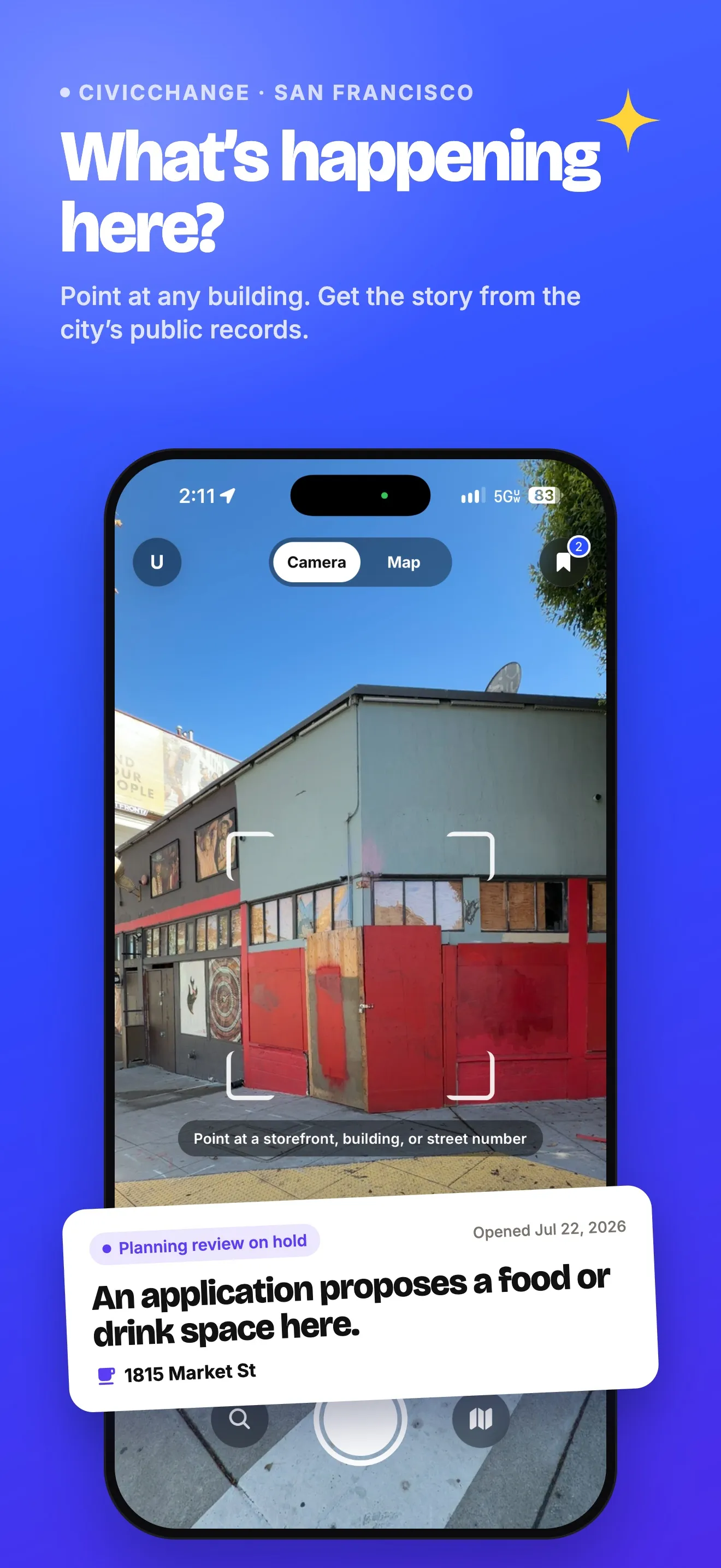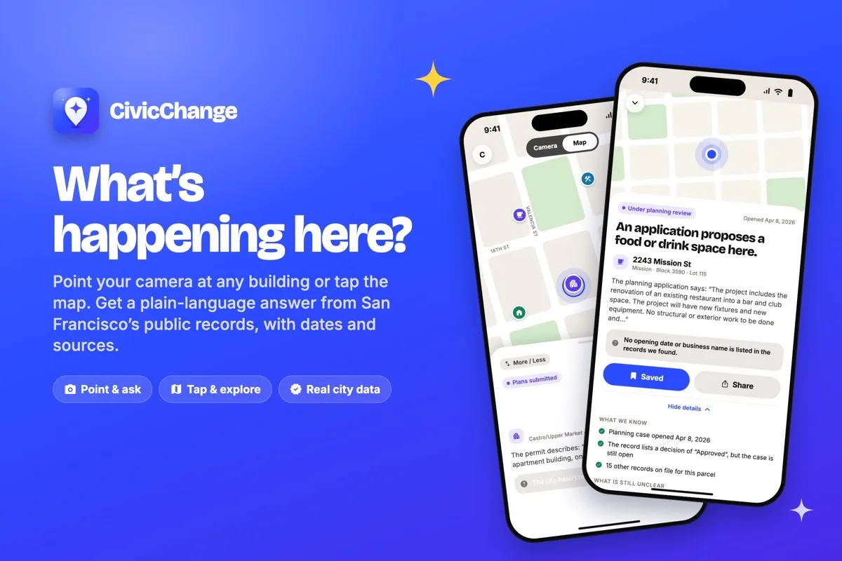
CivicChange is an iPhone app that answers "what's happening here?" for any building in San Francisco. Take a photo or tap the map, confirm the address, and get one short answer from the city's open permit and planning data: a plain headline, the documented stage, the date of the record, what is still unknown, and links to the original records. It never invents opening dates, tenants or progress, and it keeps "no record found" apart from "we can't check right now". It is free on the US App Store in 8 languages, with no account needed and no ads, tracking or analytics.
The problem
People walk past boarded-up storefronts, construction fences and posted notices every day and have no easy way to find out what is going on. The answer is usually in San Francisco’s public records, but reading them means knowing about permits, parcels and city departments.
Those records are also easy to over-read. An application is not an approval, and an issued permit doesn’t mean work has started. An app that turns them into “coming soon” headlines would mislead people.
What we built
You take a photo of a building or tap any spot on the map. GPS knows where you are standing, not what you are looking at, so the app shows nearby addresses on a mini map and you pick the one you meant.
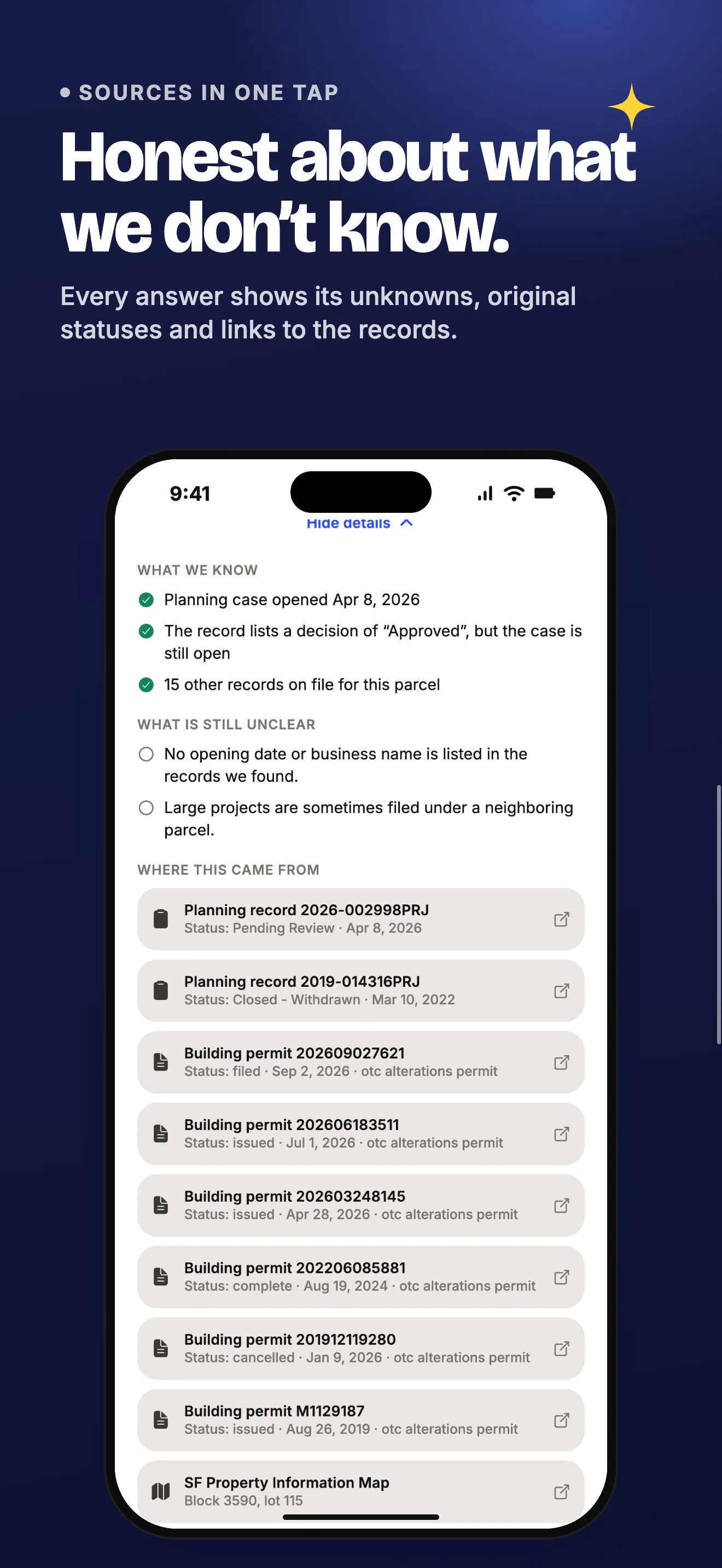
Then you get one answer card: a headline, the documented stage (such as “Plans submitted” or “Permit issued”), the date of the record, the most important thing that is still unclear, and links to the original permit and SF Planning’s Property Information Map. Routine work like fire alarms and re-roofing is down-weighted, so it rarely becomes the headline.
You can save places to a list called “Places I’m curious about”. No account is needed. Photos stay on the phone, and location is only used to narrow nearby addresses. Signing in with email syncs saved places through Firestore, and the account can be deleted in the app.
The app and its App Store listing come in 8 languages: English, Spanish, Chinese (Simplified and Traditional), Vietnamese, Russian, Korean and Japanese. It has light, dark and system themes and supports Reduce Motion.
How we built it
The app is Expo and React Native with Expo Router. It queries three DataSF datasets directly, for one parcel or map area at a time, never the whole city. A small module turns the records into an answer: it picks the most significant recent record, maps its status to a stage, and writes a careful headline.
Most of the build happened in two days, October 22 and 23, 2026. Claude is listed as co-author on 53 of the 54 commits. The App Store build script and listing were committed late on the first day. The iOS build number has since reached 14.
Tests pin the wording rules: a filed application is described as a proposal, a completed permit covers only that permit, and an unknown stays unknown. Other tests check that every language has the same keys and placeholders, and that Firestore rules keep each user’s saved places private. A GitHub Actions workflow is set up to run typecheck, lint and tests on every push.
The website at civicchange.app is plain HTML and CSS on Cloudflare Pages, using the app’s colors, fonts and real screens.
What was hard
Saying only what the record says. Every stage has its own wording, written into all 8 language catalogs. “We haven’t found a recent city record” and “We can’t check for updates right now” are always different messages. When a planning project spans several parcels and may list only its main one, the answer says so under “What is still unclear”.
Picking the right building. A photo alone can’t identify a building, and GPS can put you across the street. Instead of guessing, the app lists numbered nearby candidates that match pins on a mini map, keeps units in one building together, and falls back to address search when location is off.
Keeping the backend free and always on. The first version used Supabase. The day after, accounts and sync moved to Firebase so hosting stays on the free Spark plan and never pauses. Firestore rules check the exact shape of a saved place and require a confirmed email, and emulator tests cover them.
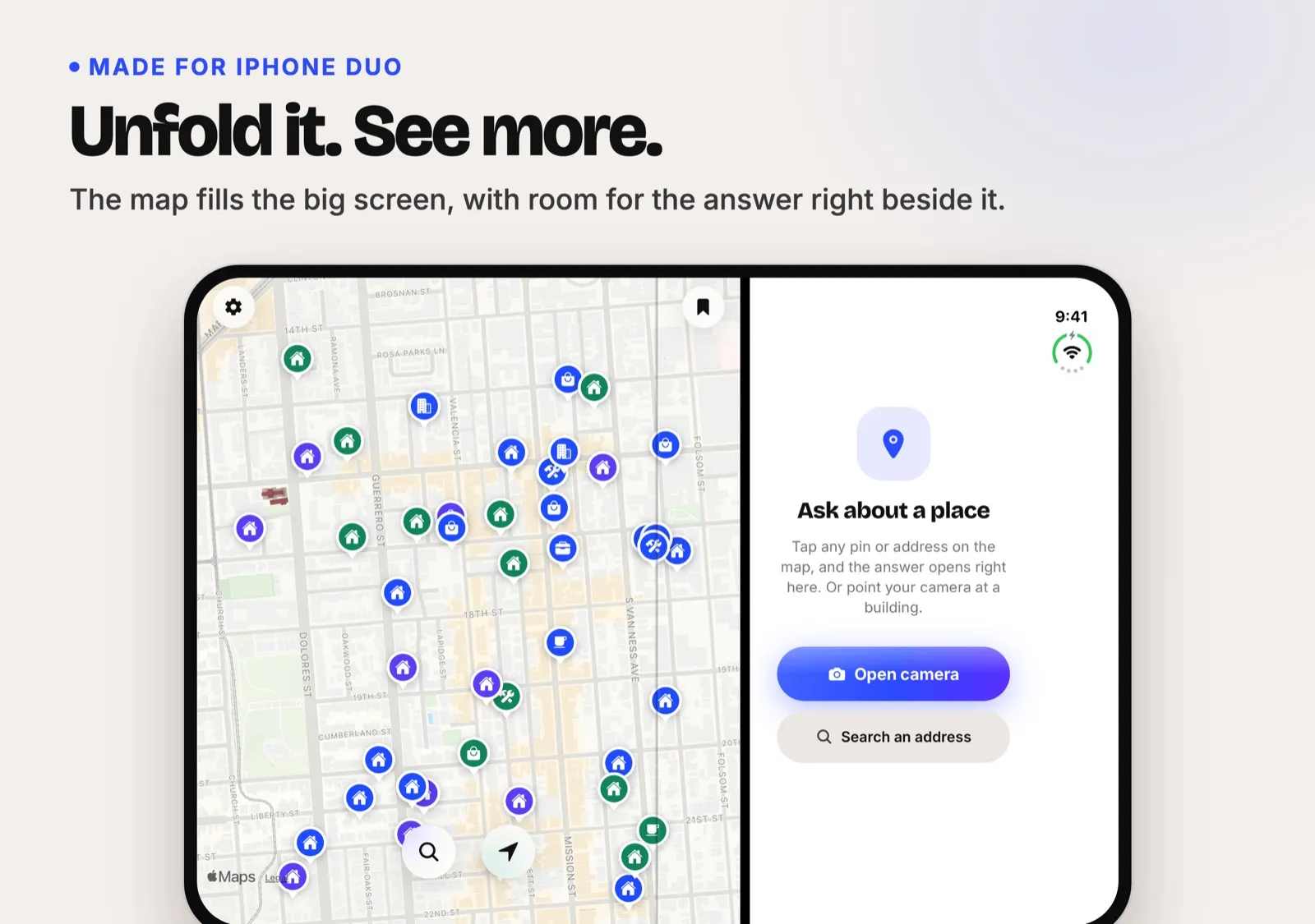
A folding screen. Version 1.1.0 adds a layout for iPhone Duo. Layout follows window size instead of device type. When unfolded, the map takes the big screen, answers open in a side pane, and the camera only runs when you ask for it.
By the numbers
- 54 commits on main between October 22 and November 7, 2026, with 42 of them in the first two days
- 53 of the 54 commits list Claude as co-author (40 Claude Sonnet 5.5, 13 Claude Opus 5.5)
- No pull requests: every commit went straight to main
- 8,261 lines of TypeScript in the app’s source
- 34 test cases in 4 test files; the four translation checks run once per language
- 3 DataSF datasets and 8 languages
- iOS build number 14; first public App Store release November 4, 2026
Where it is now
CivicChange is free on the US App Store. Version 1.1.0, with the iPhone Duo layout, was released on November 10, 2026. civicchange.app is live with privacy and support pages.
The app covers San Francisco only and isn’t an official city service. Saving a place doesn’t turn on alerts, and the site says alerts will only be promised once they work. The translations were written with AI help, and the README asks for a native-speaker review before a wide launch.